I downloaded a copy of all of the GPS landmark data from some supposed source at the CIA (http://www.evl.uic.edu/pape/data/WDB/). From this, I had to get out all of the coastline and boundary data for the United States. This actually took quite a bit of labor since they have 4 levels of "useful" data, but they don't rank them strictly as "all the 1s together" and "all the 2s together" and so on. It was actually quite annoying. But in any case, I ended up using 52332 points for the United States. The only real screwup that I ended up keeping was the US/Canada border in NW Washington as the part that goes into the Pacific, and not just the land. But I don't feel like poring through all of the coastline data to figure out which points I've left out. Those points don't matter for this case because when I ran my computer program it didn't find the longest line all the way out to the ocean, so it certainly couldn't find the longest point closer in!
In any case, I tested each pair of points to see how long the distance was on the sphere we call the Earth (yes, there are approximations involved there). If the distance was over 2700 miles, I kept that pair of points. If not, I just threw it away. I took the pairs of points, as well as the original map data, and transformed them to a gnomonic projection, where all great arcs are straight lines. Next, on the gnomonic plot, I connected the points I had found if the distance was over 2850 miles. It was pretty obvious that none of these were candidates since they all left the country.
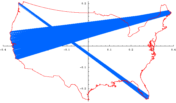
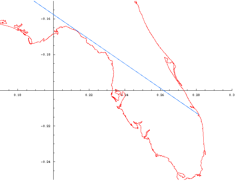
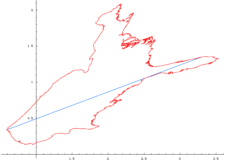
I kept lowering the limit and eventually I finally found a line that was just barely tangent to the corner of the Florida Panhandle, as I had suspected.
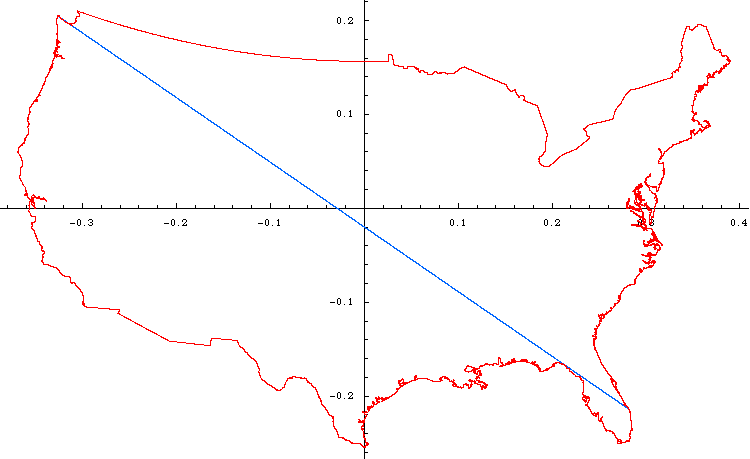
Before continuing, note that for any gnomonic projection, we get to choose where the projection plane is tangent to the sphere. If one chooses the tangent plane to be tangent near the middle of the US, you get what most maps look like. If you go off-center, you get crazier shapes, but the key is that for ANY of the gnomonic plots, straight lines are great arcs. In the above plot, the map looks "normal" because I chose the tangent plane to be about in the middle of the United States. If I pick a different point, the map looks wildly different (although note that the line is still straight, as it must be for a gnomonic projection).
Also note that if we plot the line on a "projectionless" map, that is where we simply use latitude and longitude as simple x- and y-coordinates, this is what the longest line looks like (note that now it looks like a curve, since a "straight line" on a globe is actually what we call a "great arc":
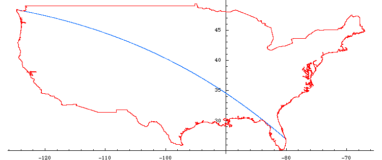
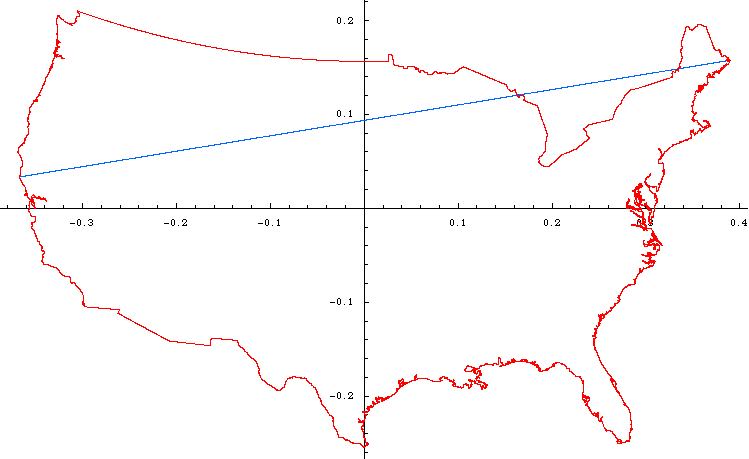
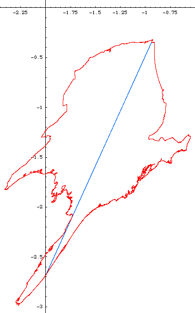
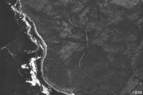
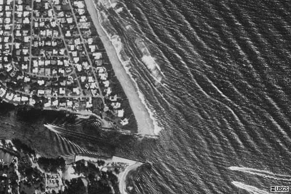
So where does this line lead to and from? Our journey starts at Ocean Creek by the Makah Indian Reservation in Washington (124° 41' 38'' W, 48° 21' 44'' N), and our amazing journey ends near 1 Ocean Drive, Jupiter, Florida, 33469 (80° 4' 29'' W, 26° 57' 11'' N). The distance between these two points is an impressive 2802 miles. Note that Ocean Creek is not the name of a city or town, but the name of the actual stream. The photos below are the property of the USGS.
Lastly, the longest line in America (continental US) that is allowed to go through another country stretches from Point Arena, CA to West Quoddy Head, ME and is shown below. It is 2892 miles long.